• Home
  • About
  • Members
    • Column 1
      • Capital Region Land Conservancy
      • Conserve Spout Run
      • Clarke County Virginia Conservation Easement Authority
      • Elks Run Watershed Coalition
      • Friends of the Blue Ridge Mountains
    • Column 2
      • Friends of the Shenandoah River
      • Goose Creek Association
      • Sleepy Creek Watershed Association
    • Column 3
      • The Downstream Project
      • Whitescarver Natural Resources Management
      • Virginia’s United Land Trust
  • Water Reporter
  • Network Map
  • Video Library
  • Join The Network!
Downstream Network SiteDownstream Network Site
  • Home
  • About
  • Members
    • Column 1
      • Capital Region Land Conservancy
      • Conserve Spout Run
      • Clarke County Virginia Conservation Easement Authority
      • Elks Run Watershed Coalition
      • Friends of the Blue Ridge Mountains
    • Column 2
      • Friends of the Shenandoah River
      • Goose Creek Association
      • Sleepy Creek Watershed Association
    • Column 3
      • The Downstream Project
      • Whitescarver Natural Resources Management
      • Virginia’s United Land Trust
  • Water Reporter
  • Network Map
  • Video Library
  • Join The Network!

Fifty one acres of land protected at Ware Bottom Church Battlefield

Home Capital Region Land ConservancyFifty one acres of land protected at Ware Bottom Church Battlefield
Fifty one acres of land protected at Ware Bottom Church Battlefield

Fifty one acres of land protected at Ware Bottom Church Battlefield

May 12, 2022 Capital Region Land Conservancy, Uncategorized

CHESTERFIELD COUNTY, VA —  Some 51 acres of land in Chesterfield County will now be protected thanks to a conservation easement recorded by the county and the Capital Region Land Conservancy (CRLC) in order to preserve the site of a key battle that took place there during the Civil War.

The conserved land will be added to the county’s adjacent 10-acre Ware Bottom Church Battlefield Park.
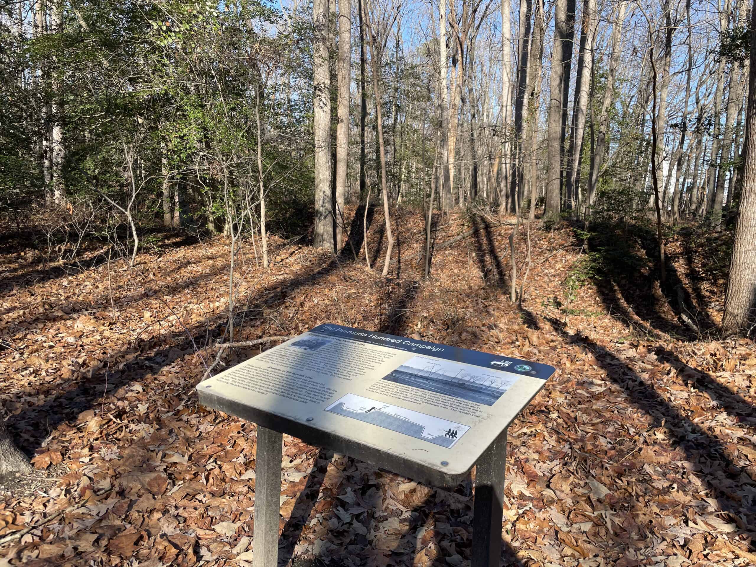
Interpretive sign at Chesterfield County’s existing 10-acre Ware Bottom Church Battlefield Park

The parcel on Old Stage Road (VA Route 735) and Old Bermuda Hundred Road (VA Route 618) was recently purchased by the county with federal funding from the National Park Service’s Land and Water Conservation Fund – American Battlefield Protection Program (ABPP), seller donation and assistance from the American Battlefield Trust. The additional park land will help bring greater awareness of the Battle of Ware Bottom Church and provide additional greenspace in a rapidly growing area of the county.

Protecting the property in perpetuity with a conservation easement and providing public access are requirements of the federal funding.

This easement is the final step towards Chesterfield County’s goal of protecting Ware Bottom Church Battlefield. The site and current park will promote awareness of the county’s history and attract cultural heritage tourism. It will also increase open space land for public access and climate resiliency in a community within a 10-minute walk of the property.
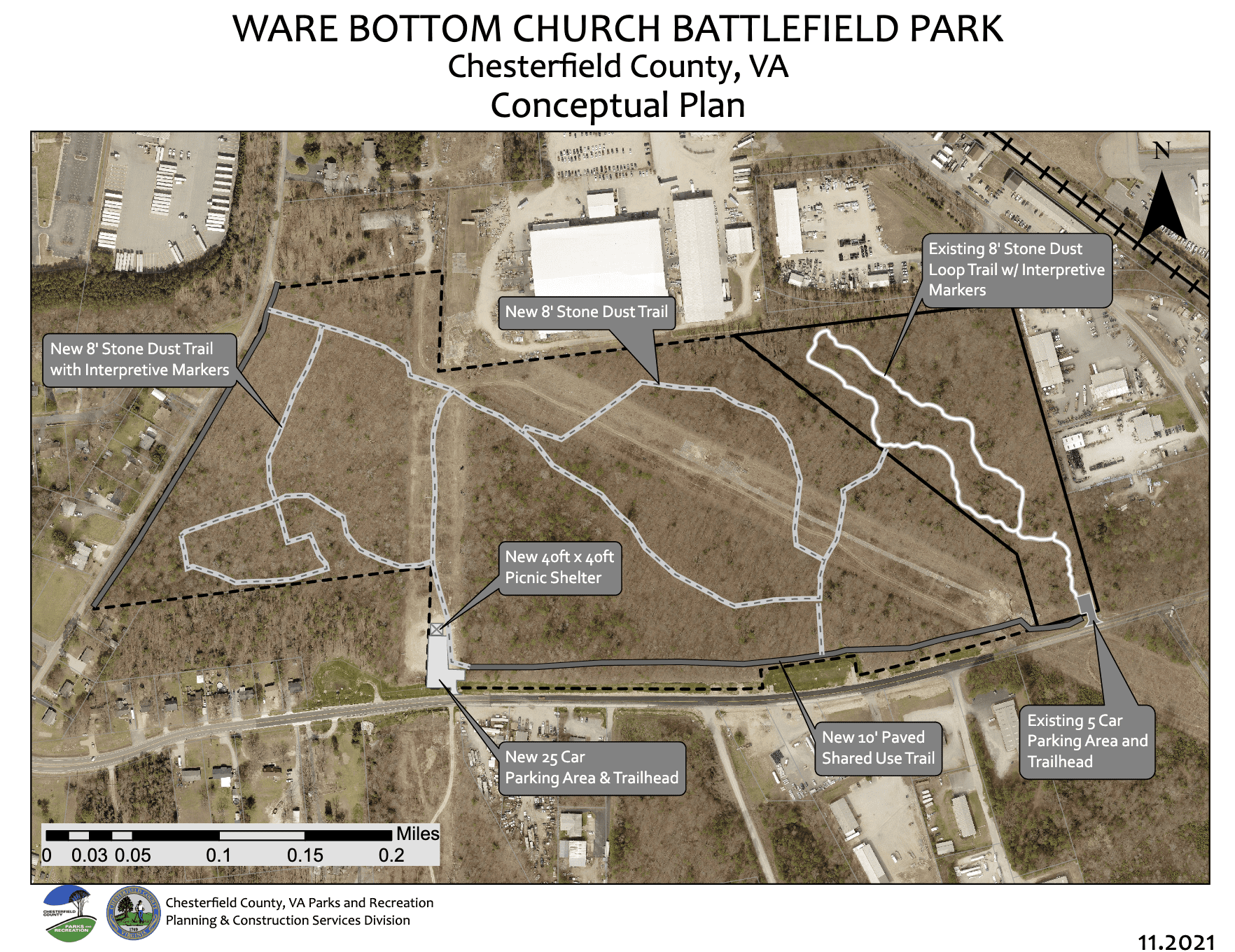
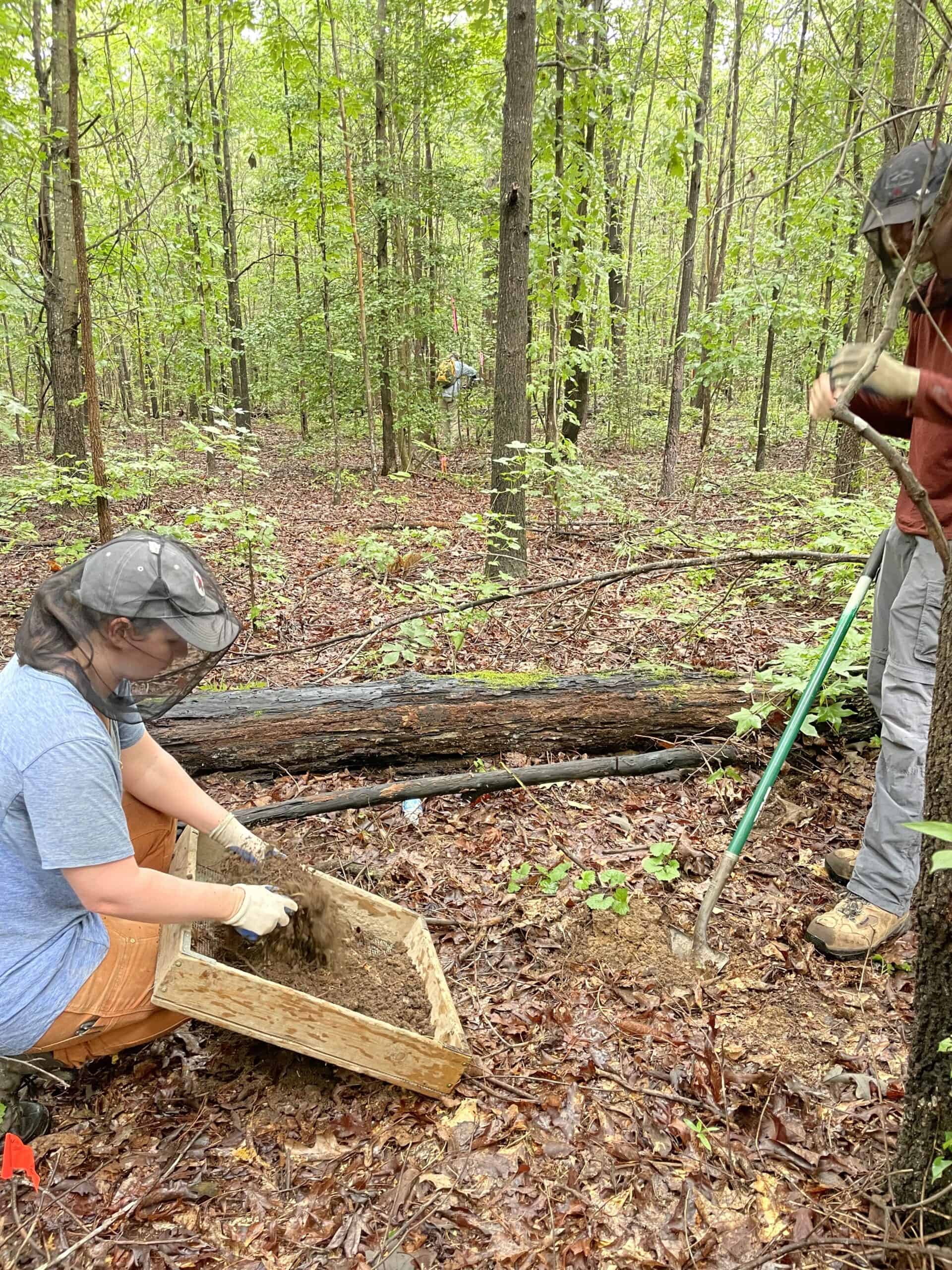
Chesterfield County Parks & Recreation’s conceptual plan to expand the park includes visitor amenities on the property, such as information kiosks, unpaved trails, a picnic or educational shelter, parking, and paved shared use path for cyclists and pedestrians along Old Stage and Old Bermuda Hundred Roads. Development plans will avoid site degradation, limit impervious surfaces, and promote historic resource and water quality protection. An archeological study has been completed for the development areas to confirm no impacts and inventory artifacts for historical interpretation.
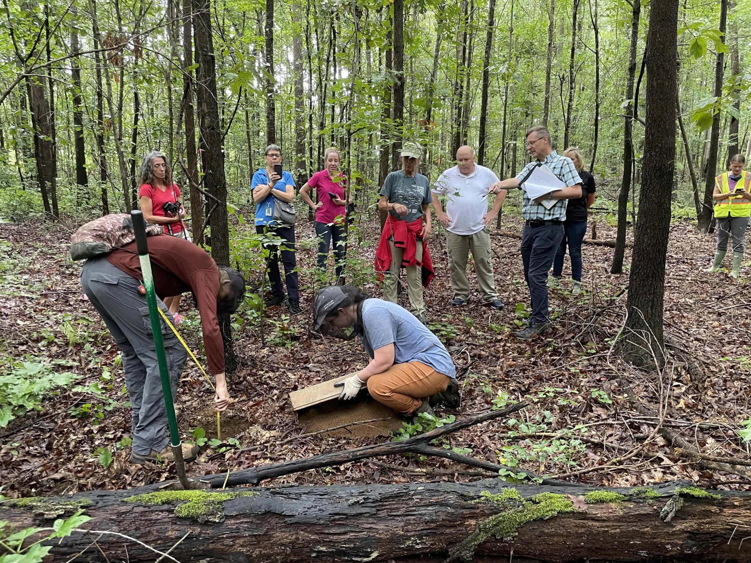


Archaeological survey work at Ware Bottom Church Battlefield

“Chesterfield Parks and Recreation is pleased that this CRLC conservation easement protects the majority of the 61.7-acre Ware Bottom Battlefield Park,” said Stuart Connock, assistant director of parks and recreation. “In the near future this newly conserved parkland will include just over one mile of unpaved trail featuring views of the Civil War earthworks. This Park is important as a destination historical site, as a part of the Bermuda Campaign of 1864, and an open space asset within the Bermuda Magisterial District.”

In addition to the historic resources protected by the conservation easement, other conservation values included in the easement are nearly 40 acres of forests and 51 acres of prime farmland.

Interpretation sign for the Bermuda Hundred Campaign of the Civil War

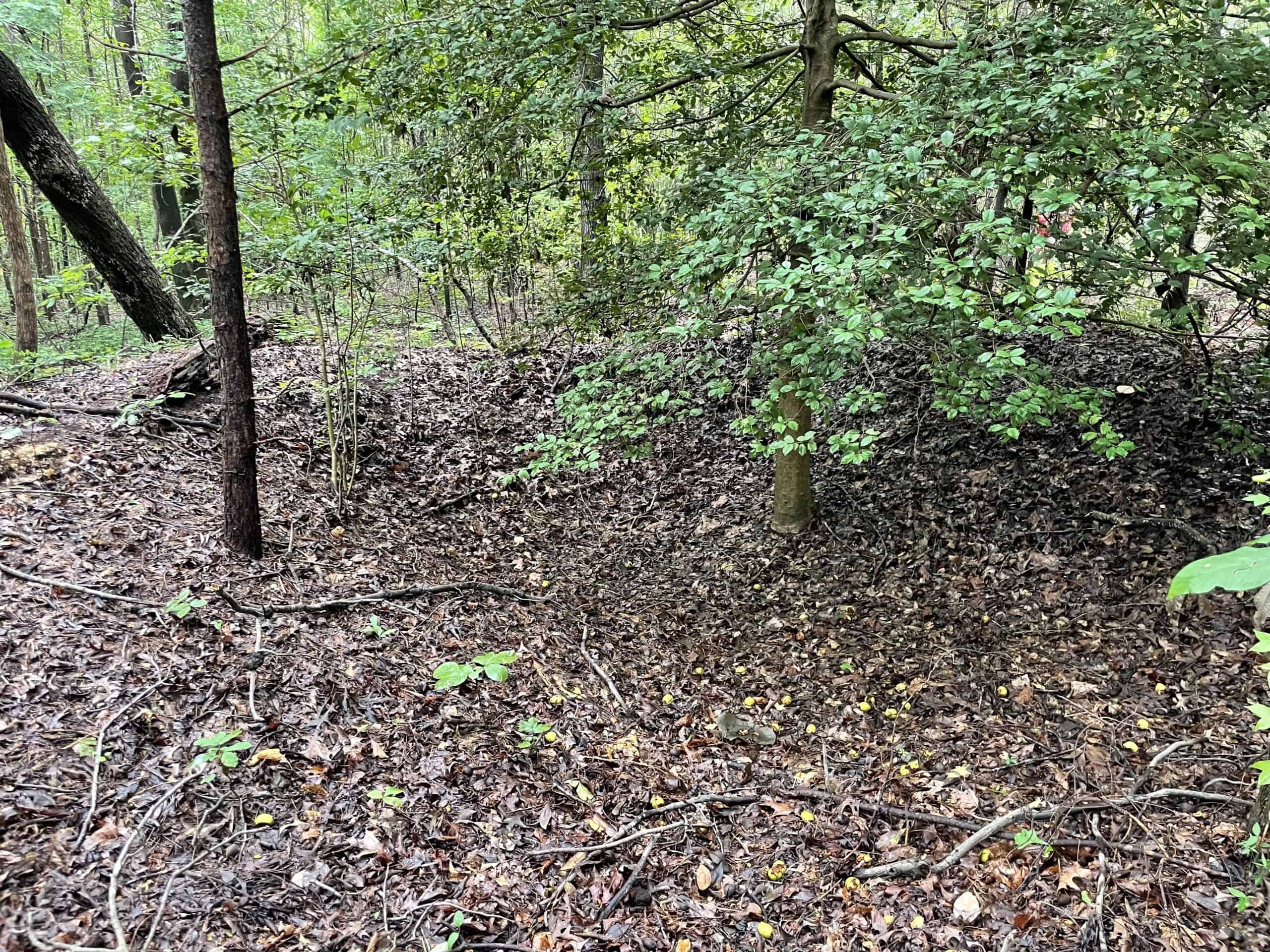
Built in 1723, Ware Bottom Church was one of two colonial churches in Henrico County south of the James River that would be included in Dale Parish when it was founded in 1735 and subsequently Chesterfield County in 1749. In May 1864 after Union General Benjamin Butler landed 30,000 troops and seized Bermuda Hundred, Union troops built two miles of earthwork fortifications between the Appomattox and James Rivers. A series of battles commenced over the next few weeks with modest gains by Butler’s Army of the James until Confederate General P.G.T. Beauregard attacked Butler’s advance picket lines on May 20 and pushed back the Union position. Immediately following the Battle of Ware Bottom Church the Confederate troops dug their own earthwork fortifications spanning three miles between the Appomattox and James Rivers known as the Howlett Line.

For more information on the Battle of Ware Bottom Church, visit ChesterfieldHistory.com.

The post Fifty one acres of land protected at Ware Bottom Church Battlefield first appeared on Capital Region Land Conservancy.

Share
0

You also might be interested in

FOSR’s 2020 Summer E. coli Results through 07.01.2020

Jul 2, 2020

As everyone is gearing up for the 4th of July,[...]

$500,000 in Farmland Preservation Grants

$500,000 in Farmland Preservation Grants

Jan 15, 2017

Governor McAuliffe Announces $500,000 in Farmland Preservation Grants~ Four counties,[...]

Tell WV DEP: Protect the health of West Virginians. Reduce PFAS discharges into the Ohio River!

Tell WV DEP: Protect the health of West Virginians. Reduce PFAS discharges into the Ohio River!

May 24, 2023

The Chemours Washington Works facility in Parkersburg has applied for[...]

Network Members

  • Capital Region Land Conservancy
  • Clarke County Virginia Conservation Easement Authority
  • Conserve Spout Run
  • Elks Run Watershed Coalition
  • Friends of the Blue Ridge Mountains
  • Friends of the Shenandoah River
  • Goose Creek Association
  • Sleepy Creek Watershed Association
  • The Downstream Project
  • Whitescarver Natural Resources Management

Recent Network Posts

  • WV Public Lands: October Edition
  • WV Public Lands: October Edition
  • WV Rivers Coalition Challenges State Attorney General’s Investigatory Subpoena
  • A Night to Celebrate the Mountain: TeKrony and Kaine Honored
  • New Technical Advisory Council Brings Expertise to Water Protection in West Virginia

Network Posts Archive

Contact Us

We're currently offline. Send us an email and we'll get back to you, asap.

Join us Today! Learn More

Find Us on Facebook and Twitter

© 2026 · The Downstream Network

Prev Next

Press Enter to search · Esc to close